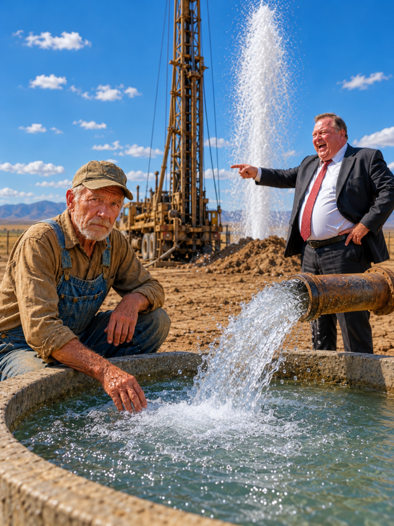
the bank sold the old man eighty four acres of dead land for fifty eight hundred dollars and three years later came back for the nine million dollar aquifer they never knew was under it
Part 1
The bank manager watched the old man sign the last page and turned to the clerk beside him. “Stamp it fast before he comes to his senses.” The clerk smiled. No one else in the room offered a dollar more. Good farmland in the valley was bringing more than fourteen hundred an acre that fall. These eighty-four acres had sat empty for nearly twenty-five years. Both old wells were dry. The grass had burned yellow. Deep erosion cuts ran across the slopes like open wounds. The bank had taken the place after a bankruptcy and tried to sell it at three different auctions. Nobody wanted it. To the men behind the counter, fifty-eight hundred dollars was simply a way to clear a bad asset from the books.
The manager said it out loud so the room could hear. The old man had just bought eighty-four acres of property taxes and rocks. One of the clerks added that if he picked up the stones and sold them along the highway he might earn some of the money back in a few years. The old farmer did not argue. He folded the deed, slipped it into his coat pocket, and asked for every remaining record connected to the property. The papers the bank considered trash were the first things he wanted to take home.
Inside the pile they had planned to throw away was an old file box. It held a 1948 topographic map, a soil survey, bills from two failed well-drilling attempts, and notes from an irrigation engineer who had once worked in the area. His father had told him years ago that land was rarely truly dead. More often, people had simply treated it the wrong way for too long. So he did not rush to plant anything. First he wanted to understand what had destroyed those eighty-four acres.
He was sixty-nine. His own place sat three miles down the county road, and he had spent the last forty years learning which fields held water and which ones only looked like they did. He parked the truck at the edge of the new ground and walked it for three days before he touched a tool. He watched where rainwater moved, where the grass showed a different color, which patches stayed cooler in the morning, and where years of runoff had carried the topsoil toward the drainage ditch on the south side. To everyone else it looked like he was wasting time. He was reading the land before he decided where to begin fixing it.
He divided the property into thirty-six smaller sections, marked each one with numbered stakes, and dug test holes by hand. He wrote down the depth, soil color, moisture, roots, and amount of rock in each section. A clear pattern appeared. About sixteen inches below the surface sat a layer of clay packed so hard his shovel bounced off it. More than forty years of plowing at the same depth had created a sealed pan under the soil. Water could not move down. Roots could not push through. Every heavy rain carried more topsoil toward the ditch.
For months people around town saw him measuring dirt, digging holes, and writing in a notebook without growing anything. At the breakfast diner they started calling the eighty-four acres the dirt graveyard. They joked that he had spent almost six thousand dollars just to buy himself a place to dig holes for fun. He never explained himself. By then he was almost certain the real problem was not the rocks. It was the hard compacted layer that had been building under the soil for decades.
Part 2
Once he knew he was dealing with compacted soil, he bought an old subsoiler and rebuilt it using parts taken from a 1960s tractor. He chose only six acres near the barn for his first test. On the third day the hard ground bent one of the steel shanks almost in half. He removed it, heated the steel, hammered it back into shape, and went back to work the next morning. If his idea was wrong, he wanted to be wrong on six acres, not all eighty-four.
After he opened the first deep cracks through the compacted layer, he planted rye, clover, and deep-rooted radishes. He was not growing them to sell. Their roots were there to continue the work the steel had started. During the winter the radishes died and broke down underground, leaving channels in the soil. Then spring brought a heavy rain and the first real proof. Water still ran muddy across the untouched ground and poured toward the ditch. But on the six test acres most of the rain soaked straight into the ground. His method was working.
From that point on he expanded the restoration slowly—about eight to ten acres each season. Old hay, crop residue, and manure went back onto the soil instead of being cleared away or plowed under completely. The work moved so slowly that almost nobody saw it as a serious plan. Some people told him to borrow money from the bank, buy bigger equipment, and finish the job faster. He refused. He had just bought land the bank considered worthless. He was not about to hand control of it back to the same bank simply because he wanted to move faster.
Nearly two years passed before the difference became too obvious for people driving by to ignore. The first six acres stayed green longer during the dry season. The ground cracked less, and the small erosion cuts that once crossed the slope began to fade. After every heavy rain the untreated ground still sent muddy brown water toward the road, while the test area held most of the water where it fell. The land people had called the dirt graveyard was finally proving that it had never been dead.
That was when the bank came back for the first time. One afternoon the bank manager pulled up beside the fence. He stood there looking at the section of land that was noticeably greener than everything around it, then told the old farmer the bank was willing to pay twelve thousand dollars for all eighty-four acres. That was more than twice what he had paid. The manager called it a chance to walk away with a nice profit, as if the bank were helping him escape a bad decision. But the old man understood what was happening. The same people who had laughed at this land were starting to see something they had missed before.
He asked the manager directly why land he had once called rocks and property taxes was suddenly worth twice as much. The man only said the bank was restructuring its land holdings and offered no real explanation. The old farmer looked across the fence at the first green patches spreading over the damaged ground and gave him one answer. “This land isn’t done talking yet.” Then he went back to work and watched the bank manager drive away without a signature.
Part 3
As he continued restoring the rest of the property, he started paying closer attention to a small corner in the northwest, less than one acre in size. By late summer, when most of the grass across the farm had turned yellow, the wild willows and sedges there were still deep green. The soil under his boots also stayed softer and cooler, even when the ground around it had become hard and dry. At first he simply marked it as something unusual. But the longer he watched it, the clearer it became that this small area was not reacting to the drought like the rest of the farm.
Previous owners had treated that corner as useless wet ground and dug a ditch to drain water away from the hillside. The old farmer pulled out the 1948 map from the file box and placed it beside a current map. Right where the willows were growing, there was a small mark showing that a natural seep had once existed there. To most people the detail would have meant nothing. To him it mattered. He decided to dig a shallow trench along the contour of the hill, not to drain water away, but to see if he could intercept water moving quietly through the slope.
A few days later what he was waiting for actually happened. Cold water began to appear along the side of the trench. At first it came as a slow drip, then turned into a steady seep. But the success lasted less than a week. He had dug too deep. After a small collapse, fine mud slid down, covered the seep face, and the water disappeared completely. He did not hide the failure, and he did not fill the trench and pretend it had never happened. He measured the depth again, wrote down what went wrong, and treated the failure as another piece of the problem. He partly filled the trench and tried again. This time he kept a gentler slope and left the surface rough so fine mud would be less likely to seal off the water. The result was better. Water started flowing again at only about one gallon per minute, nowhere near enough to irrigate eighty-four acres. But the important part was that the flow stayed almost steady through the rest of the summer. While shallow wells around the valley rose and fell with rainfall, this small flow barely changed.
To the old farmer it was the first real sign that a different source of water might exist beneath the property, separate from the shallow groundwater everyone else depended on. He went back to the old file box and read every page more carefully. In notes written by an engineer in 1952 he found one short line: “Rounded gravel found beneath deep clay on western side. Possible ancient river channel not confirmed by drilling.” He circled the sentence in his notebook and compared it with the location of the seep on the map. The two clues seemed to be pointing toward the same thing. But drilling a deep well would cost far more than he could afford. He had no equipment, no extra money, and not enough proof to risk everything. So for the moment the clue had to stay on paper.
At the same time the drought entered its second year and began changing the entire valley. Small ponds dried down until their bottoms were exposed, and the mud along the edges cracked into hard plates. Many shallow wells dropped more than twenty feet, forcing farmers to lower their pumps or shut them down completely. Farms began mounting large water tanks on trucks just to keep animals supplied. People who had never imagined paying for livestock water were now waiting in line for tanker deliveries. Water, something everyone had always treated as dependable, had suddenly become a matter of survival. And very quickly the farmer’s water problem became the bank’s problem too. Most of the farms running short on water had mortgages with the same bank that had sold the old man those eighty-four acres. Crops failed. Ranchers started selling off cattle, and requests for loan extensions increased week after week. If the drought lasted another year, a large number of those loans could turn bad.
While the bank began worrying about the future of the entire valley, the old farmer still had the 1948 map, the 1952 note, and that small steady flow of water coming from the northwest corner. By the third summer the bank manager showed up at the fence again, but this time he was no longer talking about twelve thousand dollars. The new offer was sixty-five thousand for all eighty-four acres. He called it an unbelievable price for low-grade land, then deliberately reminded the old farmer that a man pushing seventy should not let pride keep him from making money. But the old man was not focused on the number. He was watching the same man who had once laughed at this land now trying to buy it back for more than ten times what the bank had sold it for.
He asked him directly why a bank that was happy to sell this land for fifty-eight hundred dollars now wanted to pay sixty-five thousand for it. The manager only said they were buying strategic land for the future, then quickly tried to move the conversation toward a contract. The old farmer refused on the spot. That night he spread the 1948 map across his table and placed it beside the 1952 note, the location of the seep, and the areas that were still green during the drought. He compared every point carefully. If the bank had noticed something, he wanted to know exactly what they had seen before it was too late.
Part 4
The drought kept getting worse until the county government was forced to step in. A hydrogeologist was hired to survey underground water using electrical resistivity equipment, looking for areas that might hold water deep below the surface. She surveyed twelve farms in the area before reaching the old farmer’s property. The results from all twelve were almost the same. The shallow aquifer that depended on rainfall had become much thinner, and in many places it was close to running dry. It confirmed what everyone had already felt for two years. The valley’s normal water supply was no longer enough.
When the equipment was brought onto the eighty-four acres, the survey team started near the willows in the northwest corner and ran their first line across the part of the property that had once been considered the worst. The shallow layers showed nothing unusual. There was thick clay, hard rock, and difficult drilling material, exactly the kind of ground that had caused two previous owners to fail and give up. If they had looked only near the surface, the property still matched the bank’s old description. Dry, heavy, and nearly worthless. But the survey team kept looking deeper. When they widened the spacing between the electrodes to read more than one hundred and seventy feet below the surface, the readings on the screen changed sharply. A large conductive zone appeared beneath almost half the property. It looked nothing like the small broken signals they had seen on the other farms. This zone was wide, continuous, and buried deep beneath the clay and hard rock above it.
The lead geologist stopped and checked the equipment. If the readings were correct, something existed beneath those eighty-four acres that they had not seen anywhere else during the survey. The hydrogeologist refused to make a quick conclusion. She ordered the entire survey line moved to three different locations to rule out equipment problems or errors caused by the shape of the land. On the second line the same zone appeared again. On the third it was still there. By the fourth line the depth and shape were almost identical. When she put the cross-sections together, a clear picture formed. Beneath the clay and rock was a layer of water-filled gravel and sand stretching in a distinct direction. Its shape looked like the channel of an ancient river buried beneath the valley long ago. And the greatest irony was that the same geology that had made the land seem worthless was exactly what had protected the water below. The thick clay and rock that everyone hated acted like a sealed cover. It reduced water loss toward the surface and separated the deeper aquifer from the shallow wells being heavily pumped across the valley. The two failed wells from years earlier had not proved there was no water underground. They had simply stopped drilling too soon. What people had seen as the curse of those eighty-four acres was actually the shield protecting the most valuable thing beneath them.
The county decided a test well was the only way to know for sure. They chose a drilling site where the survey lines crossed. The drill pushed through clay, rock, and the same hard layers that had stopped the previous owners. At one hundred feet, then one hundred and fifty feet, there was still nothing but dry, heavy material. But at around one hundred and eighty-one feet the sound of the drill suddenly changed. Wet gravel began coming up with the drilling mud. After the well casing was installed, something even more important happened. The water level rose on its own to nearly one hundred feet inside the casing before a pump was ever turned on. But finding water did not automatically make the aquifer valuable. The real questions were how much water it could produce and how quickly the level would fall under heavy pumping. The county ran a continuous twenty-four-hour pump test. The flow was pushed above four hundred and twenty gallons per minute. Yet the water level in the well dropped only slightly. While many wells around the valley were struggling to produce far less, the well on the eighty-four acres kept delivering almost the same strong flow. Even after hours of non-stop pumping, the aquifer showed very little sign of weakening.
Water samples were then sent to a laboratory for quality testing. The results were even more surprising than the pumping test. Nitrate levels and agricultural chemical residue were both very low because the deep aquifer had been isolated by the geology above it for a long time, protecting it from much of the farming activity at the surface. Compared with most wells already being used across the county, the water from this deeper source was clearly cleaner. At that point the final pieces came together. The eighty-four acres of dead land could not only be brought back to life. Beneath it sat one of the most valuable water sources in the entire region.
Part 5
The final report was presented at a county meeting. The people who had once called the eighty-four acres the dirt graveyard sat quietly as the hydrogeologist confirmed that beneath the property was one of the most stable groundwater sources in the region. The bank manager was no longer laughing either. After the meeting he offered to have the bank manage the well, the pipelines, the contracts, and the entire water distribution system. But the old farmer understood what that could mean. Once he gave up management, control of the water could slowly move out of his hands as well.
Not long after that, an investment company connected to the bank offered more than nine million dollars for the rights to pump from the aquifer. They did not need to buy the farm. They only wanted the right to pump water at commercial volume. The old farmer studied their projected numbers and understood what they meant. A water source that had rested underground for thousands of years could be drained in a small fraction of that time. The size of the offer did not change his decision. He turned down both the bank’s management offer and the nine-million-dollar deal. The land was not for sale. The water rights were not for sale. Any water supply contract would last only one year, and the water had to go directly to local farming and ranching.
The first person who came asking for help was one of the farmers who had stood beside the bank manager and laughed on auction day. Now his well was dry, and dozens of his cattle were surviving on water hauled in by truck. All he could do was ask whether the old man could sell him enough water to save the herd. The old farmer did not take revenge. He sold the water at cost plus a small profit. But every farm receiving it had to meet certain conditions. They had to break up their compacted soil, plant cover crops, and build recharge areas that would help rainwater soak back into the ground. The first farms that followed the plan began holding more rainfall, losing less soil to erosion, and needing less irrigation. Soon others quietly joined them. Part of the money from water sales was used to build recharge ponds above the gravel layers, holding spring flood water long enough for it to soak underground instead of running away.
The land once considered worthless had become the place that taught an entire valley how to protect its water for the future. The old man stood at the northwest corner one evening after the last of the light had left the slopes. The willows were still green. The small seep he had opened by hand still moved a steady thread of cold water along the trench. Below it, deeper than any of them had known to look, the gravel channel waited. He had not planted a single commercial crop on the place in three years. He had not borrowed a dollar. He had not sold the rights that would have made him rich and left the valley dry. He folded the 1948 map and put it back in the file box on the truck seat. The bank manager’s truck was gone from the road. The cattle on the neighboring places were drinking water that had come from ground the bank had once called dead. He closed the gate, locked it, and drove home through the dark. The land was still talking. He intended to keep listening.